Closed for how long, exactly
When a park or walkway here closes for construction, the closure comes with a stated duration. This page is the ledger for those statements. It also tracks a quieter problem: what counts as reopened. A park can be declared open while its buildings, restrooms, paths, and most of its entrances stay fenced, and the record below notes each time that happened.
The honest unit for these closures is not months, it is childhoods. A kid who turned seven the week Wagner Park closed was ten by the reopening.
32 months
Wagner Park, closed November 16, 2022 with roughly two years promised, reopened in part July 29, 2025
Esplanade closures, block by block to 2030
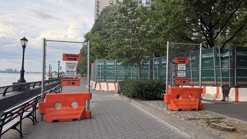
The North/West project will take the waterfront walkway in front of the Gateway, Hudson Tower, Liberty House, Liberty Terrace, and Regatta buildings out of service one segment at a time, from the marina down to South Cove. The map below recreates the BPCA's own staging graphic. These are the agency's stated start dates and its own "approximately N months" durations. North/West BPC project page.
The Regatta
About 23 months
Area 6D, South Cove end
Spring 2028 to about Mar 2030
Easement agreement reached
Liberty Terrace
About 31 months
Area 6C, near Rector Place
Fall 2027 to about May 2030
No easement agreement reported as of October 2026; the BPCA describes a potential redesign to build without one
Liberty House
About 31 months
Area 6B, Rector Place to Albany Street
Summer 2027 to about Feb 2030
Easement agreement reached with Hudson Tower, none reported with Liberty House as of October 2026
Hudson Tower
About 31 months
Area 6B, Rector Place to Albany Street
Summer 2027 to about Feb 2030
Easement agreement reached with Hudson Tower, none reported with Liberty House as of October 2026
Gateway Plaza
About 50 months
Area 6A South, Albany Street frontage
Fall 2026 to about Nov 2030
Easement agreement reached
About 29 months
Area 6A North, toward the marina
Summer 2026 to about Nov 2028
Easement agreement reached
A plan view, redrawn from the BPCA staging map: the highlighted esplanade construction ribbon follows the Hudson shoreline from South Cove to the marina, with the building footprints and streets inland of it. Each ribbon segment is shaded by how long it stays closed, the darker the longer, and labeled with its stage, start, and duration. Buildings drawn with a dashed outline (Liberty Terrace, Liberty House) had no easement agreement with the BPCA as of October 2026. Source: BPCA staging map published in The Broadsheet, July 2026, corroborated by the BPCA's March 11, 2026 community Q&A, with the 6A starts as the BPCA restated them on October 13, 2026.
The same segments on a calendar. Bars run from each segment's stated start to that start plus its stated duration, with the 6A starts as the BPCA restated them in October 2026. Read together, they show the southern Esplanade under continuous construction from summer 2026 to roughly late 2030. The BPCA's own end dates for the two 6A segments, the third quarter of 2028 and the second quarter of 2030, have not moved with the restated starts, so its starts, durations and ends no longer add up; this page shows the arithmetic.
Add the segments up and the walkway in front of these five buildings carries about 164 months of construction closure, more than thirteen years of frontage taken out of service, compressed into a little over four calendar years. No single stretch escapes it. The Gateway Plaza frontage alone, Area 6A South, is closed for about 50 months, more than four years for one block of esplanade. A child who starts kindergarten this fall will be a fourth-grader before it reopens.
Two of the segments are not even settled. The BPCA has easement agreements with the Regatta, Hudson Tower, and Gateway Plaza, but none with Liberty Terrace or Liberty House, whose boards, a BPCA source told The Broadsheet in July, wanted independent engineering studies rather than the agency's designs. In July the BPCA said it was redesigning the flood wall outside those two buildings so it can be built without an easement; in its October 2026 answers to Gateway tenants it called the redesign potential and said it "could result in significant cost increases and schedule delays, and keep portions of the BPC Esplanade closed to the public for longer periods of time," so the durations for Areas 6B and 6C could still move.
The BPCA's March 11, 2026 Q&A adds a sixth window not shown on the staging map: Area 5E, the Esplanade Plaza, was slated to close for construction from late in the second quarter of 2026 for approximately 21 months, and the BPCA's October 13, 2026 presentation to the Gateway Tenants Association lists 'Phase 5E West Began April 2026 (21 months)'. That brings the count of distinct closure windows on this stretch of waterfront to six, none shorter than about a year and a half.
- BPCA presentation to the Gateway Tenants Association, October 13, 2026, with the restated starts
- BPCA answers to Gateway tenants' questions, October 2026
- Construction Advisory Committee meeting 5 presentation, July 17, 2026, on easements
- BPCA staging map of Esplanade construction segments 6A to 6D, published in The Broadsheet
- BPCA Community Update Follow-Up Q&A, March 11, 2026 (confirms Area 5E ~21 months, 6A North ~29 months, 6A South ~50 months, and Albany Street access during 6B)
- Construction updates, official North/West project site
- BPCA board update, June 2026, with reach-by-reach schedules
Each segment: start, duration, projected reopening, agreement status
| Segment | Buildings | Closes | Duration | Projected reopening | Agreement |
|---|---|---|---|---|---|
| 6D | The Regatta | Spring 2028 | ~23 mo | Mar 2030 | Easement agreement reached |
| 6C | Liberty Terrace | Fall 2027 | ~31 mo | May 2030 | No easement agreement reported as of October 2026; the BPCA describes a potential redesign to build without one |
| 6B | Liberty House and Hudson Tower | Summer 2027 | ~31 mo | Feb 2030 | Easement agreement reached with Hudson Tower, none reported with Liberty House as of October 2026 |
| 6A South | Gateway Plaza | Fall 2026 | ~50 mo | Nov 2030 | Easement agreement reached |
| 6A North | Gateway Plaza | Summer 2026 | ~29 mo | Nov 2028 | Easement agreement reached |
| 5E | Area 5E, the Esplanade Plaza | Construction began April 2026 | ~21 mo | Jan 2028 | Per BPCA March and October 2026 documents |
Wagner Park
Closed November 16, 2022 with roughly two years of work promised in the closure notice itself. South BPC project page.
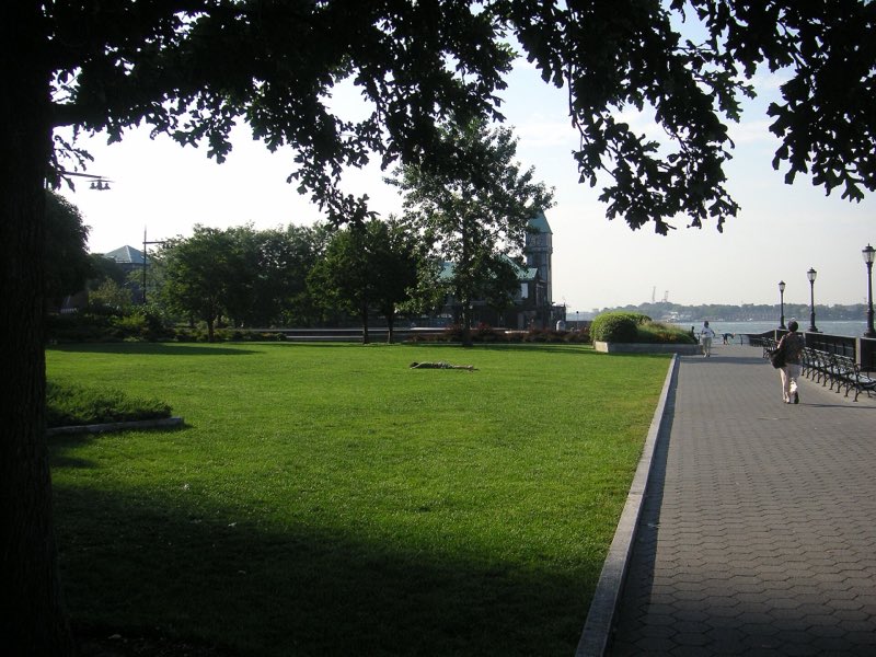
The July 29, 2025 reopening was partial. The pavilion, public restrooms, classroom, rooftop, and restaurant were all still closed, opening in phases into 2026, and the BPCA's own August 2025 notifications list continued construction at the pavilion and remaining construction items in Wagner Park alongside the line that the park is reopen.
Pier A Plaza and Battery Place edge
About 20 months of closure promised at unveiling, per the July 2022 staging presentation to CB1. South BPC project page.
Fencing went up October 16, 2023 for work the BPCA's notice said would continue through summer 2025. The June 12, 2026 notification announced that lower Pier A Plaza, specifically, was open, and the BPCA's June 4, 2026 report to Community Board 1 set further reopenings for July 4 and Labor Day 2026. Its last two-week notification still listed Battery Place and Pier A Plaza work through September 11, and the BPCA declared the whole project complete and reopened the Battery Bikeway on September 24, 2026. No BPCA document records the day the last fencing came down. The end date shown is a resident observation: this site's editors saw the plaza's fencing down on October 18, 2026, three and a half weeks after the completion declaration, with a few small areas still blocked off.
- LMCR construction staging update to Manhattan CB1
- BPCA community notice: Battery and Pier A Plaza fencing, work through summer 2025
- SBPCR two-week construction notification, June 12 to 26, 2026
- BPCA report to CB1's Battery Park City Committee, June 4, 2026
- SBPCR two-week construction notification, August 28 to September 11, 2026
- BPCA press release PR07-26 declaring the project complete
The Battery wharf, northern and western two-thirds
About one year of closure beginning March 2023, per the July 2022 staging presentation. Battery wharf project page.
The Phase 1 fence went up in January 2024, months before the May 6, 2024 groundbreaking ceremony, and the city's March 16, 2026 update to Community Board 1 reported Phase 1 complete that month, about five months after the October 2025 finish in its own earlier schedule; the mayor announced the completion on June 8, 2026. The closure ran about 26 months against the year announced.
- LMCR construction staging update to Manhattan CB1
- Battery Coastal Resilience construction notification, January 9, 2024
- Lower Manhattan Coastal Resiliency update to Manhattan CB1, March 16, 2026
- Mayor Mamdani completes first phase of Battery Coastal Resilience, NYC Mayor's Office
- Phase One Done, The Broadsheet
The Battery wharf, southern and eastern third
About six months of closure beginning June 2024, per the July 2022 staging presentation. Battery wharf project page.
Phase 2 began in March 2026, as Phase 1 finished, and the city's schedule runs it to June 2027, a closure window that will run years past the six months shown to CB1 in 2022.
North/West closures: no promised end yet
The North/West project announced its closures only after construction began, so there is no unveiling-era duration promise to hold them against. The BPCA's October 2026 answers to Gateway tenants now give dates: the Gateway Plaza north lawn is not expected to reopen before mid-2028, the Kowsky Playground and the dog run in 2030, and North Cove at the end of 2030. Pumphouse Park and the North Cove Marina are closed for the duration of full-scale construction, the Police Memorial is closed except for the NYPD, and the Esplanade closes segment by segment into 2030. The path along the west side of Brookfield Place closed in July 2026; by September 16 the BPCA described it as open except directly in front of the Winter Garden. This page will track those closures against the dates now on record.
When the paths close, where do the people go
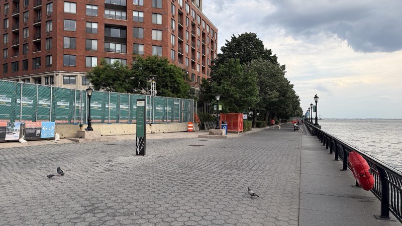
Residents describe runners and cyclists displaced from closed waterfront paths onto sidewalks and streets. Police crash data cannot see most of those conflicts, a bike hitting a walker on a sidewalk rarely generates a report, but it can show the corridor's trend, so we publish it.
Police-reported collisions in the area, by year
| Year | Crashes | Pedestrians injured | Cyclists injured | All injuries |
|---|---|---|---|---|
| 2018 | 739 | 38 | 20 | 122 |
| 2019 | 595 | 28 | 19 | 106 |
| 2020 | 175 | 9 | 10 | 46 |
| 2021 | 179 | 17 | 10 | 60 |
| 2022 | 199 | 13 | 8 | 52 |
| 2023 | 178 | 15 | 14 | 51 |
| 2024 | 186 | 26 | 13 | 79 |
| 2025 | 173 | 23 | 11 | 74 |
| 2026 (partial) | 70 | 8 | 6 | 24 |
What it shows: after the pandemic drop, crash counts in the area stayed roughly flat, while the people hurt in them rose. Pedestrian injuries roughly doubled in 2024 and 2025, 26 and 23, against 13 and 15 in 2022 and 2023, the years the fencing lines and detours spread. Correlation is not attribution: traffic patterns, tourism recovery, and citywide trends all move these numbers, and the dataset structurally misses sidewalk conflicts that never involve a vehicle. We publish the series, keep pulling it, and let it say only what it says. NYC Open Data, Motor Vehicle Collisions - Crashes (h9gi-nx95). Police-reported collisions involving motor vehicles only: a bicycle-pedestrian collision on a sidewalk with no vehicle and no police report never enters this dataset, so it understates exactly the conflicts residents describe. 2026 covers January through May, the last complete month in the dataset: the city last updated it on June 15, 2026, and later months are not yet available.
Still being assembled
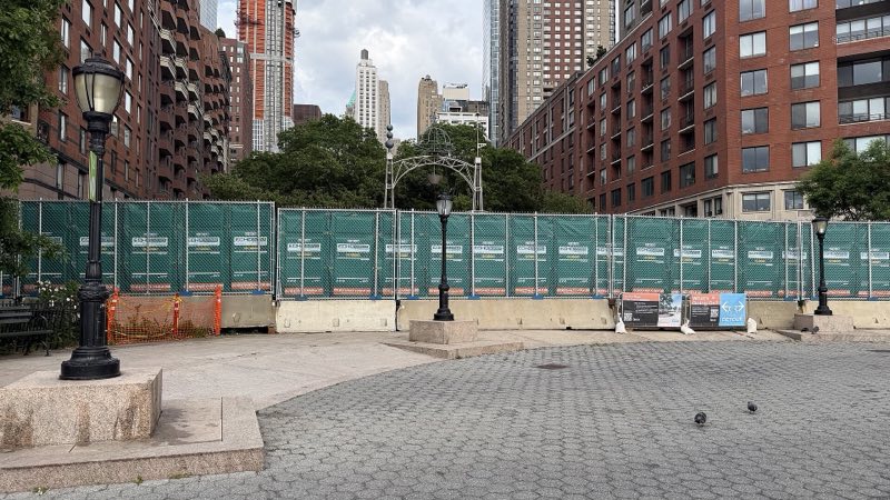
- resident-observed The texture of the partial reopenings: the narrow cut-through that constituted Pier A Plaza access in June 2026, sections opened for the July 4, 2026 celebrations and closed again afterward, and the bike paths and green space east of the main Battery entrance that remain shut. Dated photos and access logs are being compiled; until they are published, these observations stay off the ledger above.
- needs source Pedestrian detour lengths where cross-access was removed, and the South Cove closure against what the North/West phasing had shown as remaining open.